Spuren urgeschichtlicher Beackerung in West-, Mittel-, Ost- und Nordeuropa Traces of prehistoric farming in Western, Central, Eastern and Northern Europe: Eltheimer Hölzl, Bayern-Ost Bavaria-East Weiter more...
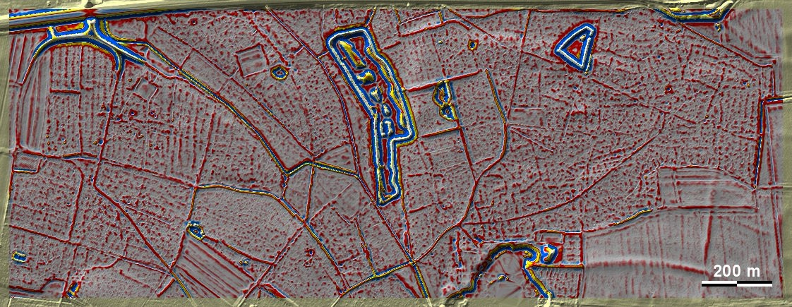
Das Eltheimer Hölzl liegt östlich von Regensburg auf lehmbedeckten Donauschottern inmitten einer Altsiedellandschaft und ist von Fundstellen aller Zeitperioden regelrecht umzingelt. Im Osten und im Westen der Grafik ist es von Spuren früherer Beackerung durchsetzt. Im Westen der Grafik sind diese Spuren offenbar mittelalterlich oder frühneuzeitlich, weil sie in dieser Form noch im Urkataster der Mitte des 19. Jhs. zu sehen sind und dieser Bereich erst später aufgeforstet wurde. Im Ostteil der Grafik wirken sie etwas chaotischer, könnten dort aber wegen Spuren übergeordneter Parzellen und einer angedeuteten Kammerung dem Typ Przemęt zuzurechnen sein. Im benachbarten Mintrachinger Holz sind die Spuren eindeutiger. The Eltheimer Hölzl lies to the east of Regensburg on clay-covered Danube gravels in the middle of an ancient settlement landscape and is practically encircled by sites from all periods. In the east and west of the diagram, it is interspersed with traces of earlier cultivation. In the western part of the graphic, these traces are obviously medieval or early modern, because they can still be seen in this form in the original cadastre of the mid-19th century and this area was only afforested later. In the eastern part of the map, they appear somewhat more chaotic, but could be attributed to the Przemęt type because of traces of superior plots and an implied chambering. In the neighbouring Mintrachinger Holz, the traces are clearer. Weiter more...