Spuren urgeschichtlicher Beackerung in West-, Mittel-, Ost- und Nordeuropa Traces of prehistoric farming in Western, Central, Eastern and Northern Europe: Premerzhofen-Ost, Bayern-Ost Bavaria-East Weiter more...
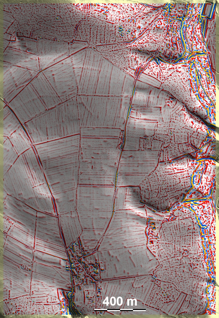
Östlich und nordöstlich von Breitenbrunn-Premerzhofen ist der Rand der Albhochfläche zum Tal der Breitenbrunner Laber mit Wald bedeckt. Dort erhielten sich 'Celtic Fields' auf Lehm- und Rohböden über Jurakalk, die Spuren einer Kammerung und übergeordneter Parzellen aufweisen und somit in das Umfeld des Typs Przemęt gehören. Im Süden der Grafik zwei kleinere Grabhügelgruppen sowie eine im Norden, mit Bestattungen der Bronze-, Hallstatt- und Frühlatènezeit. East and northeast of Breitenbrunn-Premerzhofen, the edge of the Alb plateau towards the valley of the Breitenbrunner Laber is covered with forest. There, 'Celtic Fields' were preserved on loam and raw soils over Jurassic limestone, which show traces of chambering and superordinate plots and thus belong to the Przemęt type environment. To the south of the graphic, two smaller groups of tumuli, and one to the north, with burials from the Bronze, Hallstatt and Early Latène periods. Weiter more...